
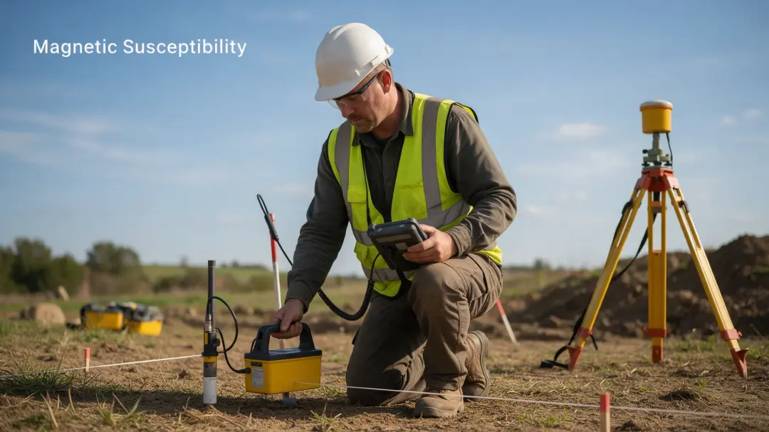
Magnetic susceptibility surveys reveal differences in how readily near-surface soils become magnetised. Their archaeological value lies in identifying broad zones of enhancement that may reflect former occupation, burning or industrial activity, while helping surveyors decide where detailed investigation is worthwhile.
Reading Patterns of Past Activity
The strongest interpretation usually comes from a spatial pattern rather than a single measurement. A coherent zone of enhanced readings may indicate a concentration of altered soil or magnetic material. Its relationship with earthworks, finds, historic maps and the geological background determines how persuasive an archaeological explanation becomes.
Susceptibility prospecting can help define an activity area even when original structures are damaged. It may suggest where to concentrate gradiometry, resistance survey or sampling. It does not directly establish a building’s date, identify individual artefacts or give the precise outline of every buried feature.
Occupation Can Alter the Topsoil
Repeated occupation introduces material into soil and changes the conditions in which minerals form. Domestic waste, organic decomposition, ash and fired-clay fragments can contribute to enhancement. These effects may accumulate across an area instead of producing the sharp pattern expected from a surviving wall.
A settlement might leave a broad topsoil signal after its shallow features have been disturbed. Different occupations leave different traces, however, and some produce little enhancement. A quiet map cannot exclude human activity. Interpretation should describe the evidence detected and explain why other remains could be invisible.
Burning and Industrial Working Areas
Heating can change iron minerals, while kilns, furnaces and discarded fired material may introduce distinctive deposits. Susceptibility can highlight an area influenced by these processes. A hotspot may include redistributed waste rather than the original hearth or furnace.
A November 2025 Sanxingdui study used laboratory heating simulations, colour and magnetic measurements to infer burning temperatures of approximately 850°C for material from Pit K4. This was a site-specific interpretation combining evidence, not a temperature that can be read directly from any field survey. Source: Journal of Archaeological Science, 2025.
Natural Soil Formation Can Produce Similar Signals
Weathering and soil development can create or concentrate magnetic minerals without archaeological involvement. Parent material, drainage, organic conditions and sediment movement affect the background. A change between natural soil units may resemble a broad activity zone unless geology is considered.
Surveyors compare enhanced areas with representative background measurements and site observations. Slope position, surface geology and recent land management help test competing explanations. The aim is to distinguish a plausible cultural pattern from variation explained by natural conditions. Sometimes the evidence cannot separate the two confidently.
What Cultivation Leaves Behind
Ploughing spreads material away from the feature that originally contained it. A compact occupation deposit may become a wider, weaker enhancement in the cultivated layer. The map then records the surviving distribution of altered topsoil rather than a pristine settlement plan.
Cultivation also mixes horizons with different magnetic properties. Changes should be assessed against field boundaries, ploughing direction and management. Detecting a residual signal on disturbed land can be useful, but the report should explain why its position may not precisely locate the original activity.
A Surface Probe Has a Shallow Response
Depth sensitivity is central to interpretation. Bartington’s MS2D specification gives a relative response of about 50% at 15 mm depth and 10% at 60 mm. These describe decreasing sensor sensitivity, not percentages of archaeology detected. Source: Bartington MS2 operation manual, checked October 2026.

Thick grass, litter and an uneven surface increase separation between probe and soil. Deep enhancement may contribute little to a reading. A surface survey is therefore topsoil reconnaissance rather than a substitute for a technique selected for deeper targets.
Sampling Determines the Detail Available
A widely spaced grid can reveal large zones efficiently but miss small hotspots between stations. Closer readings test an interesting patch and show whether it is continuous. Spacing should follow the target size and question, rather than the assumption that more coloured pixels mean more information.
Processing may interpolate between measurements to produce a smooth map. Those values are estimates, not extra observations. A useful report distinguishes the sampling pattern from its presentation and marks unsurveyed areas. This helps readers judge whether an apparent boundary is supported by measured data.
What a Convincing Interpretation Should Explain
Consider a hypothetical enhanced patch beside a former farm building. The magnetic map alone leaves several explanations: occupation debris, recent burning, imported material or a natural soil change. A responsible interpretation asks whether enhancement continues beyond the building, follows a modern access route, or coincides with supporting finds. These are questions for checking the hypothesis, not features that should be invented to make the result sound decisive.
The report should explain the local background, distinguish isolated readings from coherent zones and state how measurements were checked. It should also identify which conclusion matters to the client: selecting further survey, assessing an archaeological area or investigating disturbed soil. A recommendation becomes useful when it says which uncertainty the proposed follow-up will resolve. Simply labelling a hotspot as archaeological, without discussing competing causes or measurement limitations, gives the client less reliable information than a cautious but well-supported interpretation.
Turning the Map into an Investigation Plan
For Pre-Construct Geophysics, susceptibility is a preliminary method that can guide detailed gradiometry or resistivity. Follow-up should identify informative zones, the explanations to test and the further evidence required. The next method should answer those questions rather than merely reproduce the first map.
A client should receive a located plan, measurement units, sampling details and an interpretation separating likely activity from uncertain enhancement. Local metal, modern burning and imported soil should be considered. Where results affect archaeological management or development, targeted investigation may be needed before treating the interpretation as confirmed.
Summary
A susceptibility survey can reveal the footprint of altered topsoil and prioritise areas of possible occupation or industry. Its value depends on separating cultural enhancement from natural variation, recognising shallow sensitivity and selecting follow-up work that tests the interpretation.
Send Pre-Construct Geophysics your site location and investigation objectives to discuss whether susceptibility mapping would help define the next stage of survey.
Magnetic Susceptibility Survey