
Geophysical surveys are a useful way to explore historic sites without excavating the ground. This article explains how different survey methods can help archaeologists find buried walls, foundations, ditches, pits, roads, graves, and settlement layouts. It also looks at how these surveys help with planning excavation work, site management, and heritage protection across the UK.
What are geophysical surveys?
Geophysical surveys are used to study what is below the ground without excavating it. They help find buried remains, soil changes, and hidden features that may not be visible on the surface. They are often used before excavation so that archaeologists can understand their site more clearly and decide on what further work may be needed.
These surveys use specialist equipment to measure different properties in the ground. For example, some methods measure magnetism, some measure electrical resistance, and others send signals into the ground to detect buried layers or objects. The results are then processed into maps that show patterns, lines, shapes, and changes beneath the surface.
One key benefit is that geophysical surveys are non-invasive, meaning they cause little to no disturbance to the ground. This helps protect archaeological remains while still providing useful information.
Why geophysical surveys are used on historical sites
Geophysical surveys are used on historical sites because they help archaeologists understand what may be hidden below the surface. This is important because many historic sites contain fragile remains that can be damaged if the ground is disturbed too much.
These surveys use specialist equipment to measure changes in the soil, stone, metal, moisture, or buried layers, and the results can reveal possible walls, ditches, pits, floors, roads, drains, kilns, graves, and foundations. This gives archaeologists a clearer idea of where important features may be located.
Geophysical surveys can also show where trial trenches may be needed, where construction should be avoided, and which parts of the site may need further investigation.
Finding buried walls and foundations
Geophysical surveys can help find buried walls and foundations by detecting changes in the ground. Old stone, brick, rubble, and building remains often behave differently from the rest of the surrounding soil, and certain equipment can measure these differences and turn them into maps.
One common method is resistivity, which measures how strongly the ground resists a small electrical current. Buried walls and foundations often retain less moisture than the nearby soil, so they may show up as areas of high resistance.
Ground-penetrating radar surveys can also help find walls and foundations by sending signals into the ground and recording their reflections. This can be useful on hard surfaces, such as courtyards, roads, and built-up sites.
Locating ditches, pits and old boundaries
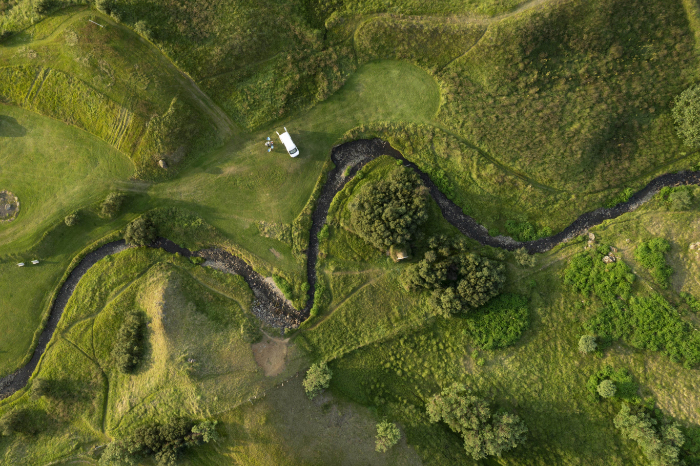
Geophysical surveys can help find ditches, pits, and old boundaries by detecting changes in the soil. These features are often created when people dig into the ground, and the excavated area later becomes full of different materials. Over time, this space can become softer, wetter, darker, or more magnetic than the surrounding natural soil.
Magnetometry is often useful for finding these features since it measures small changes in the Earth’s magnetic field. Filled ditches and pits can produce clear readings because their soil may contain burnt material, organic matter, or other changes caused by past activity.
Resistivity can also help since a filled ditch, pit, or old boundary channel can hold more moisture than the surrounding soil. Because wet soil allows electricity to pass through it easily, these features can appear as low-resistance areas.
Ground-penetrating radar surveys can also detect buried cuts and layers, especially if there's a clear difference between the fill and the surrounding ground. These surveys are useful because they allow archaeologists to map out possible features before excavation takes place.
Mapping roads, paths and settlement layouts
Old roads, routes and settlements often leave clear traces behind, even after the surface has changed. These traces can include compacted stone, gravel, rubble, drainage lines, building plots, boundary ditches, and former yards.
When geophysical survey results are processed, they can show lines, curves, blocks, and repeated patterns. A straight high-resistance line can suggest there was a former road or track, while a group of rectangular shapes may point to there being a building or settlement plot.
Curved ditches or linked boundary lines can also show enclosures, field systems, or the edge of a settlement. These results help archaeologists understand how people moved around a site, where buildings may have stood, and how the land was organised.
Detecting graves and burial grounds
Graves can affect the surrounding soil in different ways. A grave cut may disturb the natural ground, and the backfilled soil may have a different texture, moisture level, or density, and these changes can sometimes be detected by survey equipment. Grave markers, stone linings, brick vaults, paths, walls, or coffin fittings can also create survey readings.
Ground-penetrating radar surveys are often used to uncover burial grounds because they can detect changes in the soil layers and show possible grave cuts, voids, coffins, or vaults. This survey can also provide information about the ground's depth, which is helpful when you're working in churchyards, cemeteries, and historic burial sites.
Studying castles, churches and ruins
Many castles, churches, and ruins have buried walls, foundations, floors, paths, drains, graves, and earlier building phases hidden below the surface. A geophysical survey can detect changes in the ground that have been caused by stone, brick, rubble, compacted surfaces, or filled ditches. Once the results are processed, they can show lines, blocks, shapes, and patterns that may reveal a hidden structure.
Resistivity is often used on these types of sites because stone walls and foundations can appear as high resistance areas. This is because they usually retain less moisture than the surrounding soil. This survey can help archaeologists understand how a site developed over time, show where the buildings once stood, how the spaces were used, and where later changes may have taken place.

Protecting sites without digging
Geophysical surveys help archaeologists protect sites by helping them find buried remains without needing to excavate the area. This is important because excavation can disturb, weaken, or damage historic features, even when it's done carefully. A geophysical survey can provide useful information while leaving most of the ground untouched.
They can help detect walls, foundations, ditches, pits, roads, floors, drains, graves, and old boundaries, and the results are often turned into maps that can show possible hidden features. Archaeologists can then use these maps to see which parts of the site may be the most sensitive. If a survey shows important remains, plans can be made to avoid them - and this can include moving trenches, changing foundation positions, altering access routes, or protecting certain areas from heavy machinery.
Planning archaeological excavations
Geophysical surveys can help archaeologists plan their excavations better by showing where buried features may be located. This allows archaeology teams to choose their trench positions more carefully and avoid disturbing large areas.
Resistivity surveys are useful for finding stone walls, foundations, floors, roads, and compacted surfaces since these features often show up as high-resistance areas. Magnetometry surveys are useful for measuring small changes in the Earth’s magnetic field, and they are often used to find ditches, pits, hearths, kilns, and settlement activity.
Ground-penetrating radar surveys send signals into the ground and record their reflection. This survey can help show depth, and it's useful on hard surfaces, urban sites, churchyards, ruins, and places with complex layers. By comparing these survey results, archaeologists can build a clearer picture of the site, which can help guide their trial trench placements and reduce unnecessary excavation.
Comparing survey methods
Archaeologists generally compare different geophysical survey methods by looking at the type of site, ground conditions, and features they hope to find.
Resistivity is often compared with magnetometry, ground-penetrating radar, and electromagnetic surveys. Resistivity is useful for finding stone walls, foundations, floors, roads, and compacted areas because these features can affect the soil's moisture quality. Magnetometry is often better for large open fields, and it can help detect ditches, pits, hearths, kilns and settlement activity.
Ground-penetrating radar surveys can provide useful depth information, and they're often used on hard surfaces, ruins, churchyards, and complex sites. Electromagnetic surveys can help identify wider soil changes and areas of disturbance.
Archaeologists also consider practical issues, too, such as access, ground cover, weather, soil type, and how much detail is needed. For example, magnetometry may be fast, but modern metal in the ground can affect the results. Ground-penetrating radar surveys can be detailed, but they may be slower and harder to interpret. By comparing these methods, archaeologists can choose the most suitable approach or combine several surveys to gain a clearer picture of the site and plan their excavation better.
Benefits for site management
Geophysical surveys give archaeologists useful information about the site before the ground is disturbed. Many sites can contain hidden remains that may not be visible on the surface. A geophysical survey can show where buried features may be located, which can help archaeologists, landowners, planners, and builders make safer building decisions.
If important remains are found, any building work can be planned around them. This is especially important for protected sites, historic gardens, churchyards, ruins, and development land. Instead of excavating random or large areas of land, archaeologists can focus on the places that are most likely to contain important remains.
Overall, geophysical surveys can help people understand what lies below the ground, and they can help protect archaeology, guide future building work, and help preserve historic remains.
Limits of geophysical surveys
Although geophysical surveys are useful, they do have their limits. They can show possible buried features, but they might not prove exactly what is underground, and the results usually need to be checked against maps, records, trial trenches, or excavation evidence.
Ground conditions can also affect the quality of the survey. Clay, chalk, sand, peat, gravel, and stony soils all respond in different ways. Natural soil changes can sometimes look like archaeological features, which can make the results harder to read, and heavy rain, droughts, frost, or dry ground can affect the soil's moisture levels and the movement of electrical currents. This is especially important for resistivity surveys, which depend on the soil's moisture content.
For these reasons, geophysical surveys are often seen as a guide rather than a final answer. They can help archaeologists plan their work carefully, but they are usually used alongside other forms of investigation.
How survey results are recorded
Geophysical survey results are recorded in a careful and organised way so that archaeologists can understand what may be hidden under the ground. In the UK, the survey area is usually divided into a grid before the work begins, and pegs, tapes, flags, or Global Positioning System equipment may be used to mark out the area and record its location accurately.
As the survey is carried out, the specialist equipment collects readings at set points or along set lines, and the type of reading you get depends on the method that's being used. Resistivity records how well the ground resists an electrical current. Magnetometry records changes in the Earth’s magnetic field. Ground-penetrating radar records reflected signals from soil layers. Each reading is then stored with its position, so the data can be linked to a clear map of the site.
After the fieldwork is done, the data is downloaded and processed using computer software. This helps remove errors, improve the image quality, and show patterns, tones, or colours. The final results are then presented as plans, images, and written reports.
Why geophysical surveys matter for heritage protection
Geophysical surveys help archaeologists identify buried remains without disturbing the ground. Many historic sites contain walls, foundations, ditches, pits, roads, graves, floors, and old boundaries that cannot be seen from the surface. A geophysical survey can reveal these possible features and show which parts of a site may need extra care. This is important because excavation, building work, farming, landscaping, and drainage work can all damage archaeological remains if the site isn't fully understood or mapped out first.

Pre-Construct Geophysics provides professional geophysical surveys for archaeological sites across the UK. We use specialist equipment to locate buried walls, ditches, foundations, and other hidden features without needing to excavate the area.