
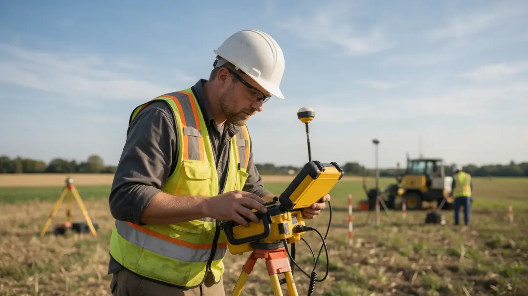
Geophysical surveyors help construction teams investigate buried features and changes in ground conditions before those uncertainties become design or excavation problems. Their role is to select suitable measurements, interpret the results and connect the evidence with an investigation plan that engineers and project managers can use.
Start with the Decision the Project Must Make
A useful construction survey begins with a question: where might a buried obstruction lie, does a proposed route cross disturbed ground, or is archaeological evaluation required? The answer determines the method, coverage and resolution. Commissioning a generic survey without a defined purpose can leave the important uncertainty unresolved.
The surveyor reviews existing site information and discusses the target with the wider team. A suspected cellar needs a different investigation from archaeological ditches across open farmland. The brief should state what evidence will be delivered and how it will inform the next stage, rather than promising that one technique finds everything underground.
Supporting Site Assessment and Layout Decisions
Geophysical measurements can extend understanding between boreholes, trenches and visible exposures. They may identify a change that requires direct testing or indicate that an assumed uniform ground model needs revision. This helps target the locations where intrusive investigation is most informative.
At an early design stage, the team may still be able to adjust a building footprint, access route or drainage alignment. Survey results provide evidence for considering those options, but the geophysicist does not independently certify foundation capacity. Design parameters must come from appropriate geotechnical assessment and the responsible engineer’s interpretation.
Finding Archaeological Constraints Before Earthworks
Former settlements, boundaries and industrial remains can affect construction programmes and development layouts. Gradiometry may map magnetic features across accessible ground, while resistance surveying can investigate contrasts associated with masonry or moisture-retaining deposits. The choice depends on the remains expected and the site conditions.

Pre-Construct Geophysics describes archaeological geophysical consultancy and methods including gradiometry, magnetic susceptibility and resistivity. These can support investigation of buried activity without extensive excavation. An archaeological adviser may require follow-up trenching to test anomalies, establish significance and decide how remains should be managed within the development.
Investigating Obstructions and Ground Variability
Demolished structures, rubble spreads and changes in made ground may produce measurable contrasts. Other specialist methods can investigate suspected voids or variations in bedrock, depending on the target. A surveyor should explain which technique is suitable and what supporting investigation it needs.
The key deliverable is a reasoned interpretation with locations and uncertainty. A feature described as a possible void should not be treated as a confirmed empty chamber, nor should a negative result become a blanket assurance of stability. Direct investigation and structural or geotechnical expertise are needed where the finding affects safety or foundation design.
Read related articles:
Geophysical Surveyors in Mineral Exploration
Common Challenges Faced by Geophysical Surveyors
Utility Detection Needs Its Own Scope
An archaeological survey may record modern services incidentally, but it is not automatically a comprehensive utility investigation. Service records, locating equipment, target depth and verification procedures must be appropriate to the excavation being planned.
HSE’s HSG47 describes a safe system built around planning the work, locating and identifying buried services, and safe excavation. A geophysical dataset contributes evidence where suitable; it does not remove the need for the other stages. Source: HSE, Avoiding danger from underground services. Electrode insertion and other ground-contact survey tasks also need appropriate preparation where buried services could be present.
Current Safety Figures Put Risk Management in Context
HSE’s provisional 2025/26 figures report 25 worker fatalities in construction and 126 across all industries in Great Britain. These are sector-wide accident statistics, not counts of incidents geophysical surveying would have prevented. Source: HSE work-related fatal injuries, 2026 release.

Ground investigation is one component of wider site risk management. Its contribution is to make subsurface uncertainty explicit and guide appropriate checks. Survey planning still needs access arrangements, safe working areas, communication with site management and controls suited to the activity. A report cannot replace the contractor’s safe system of work.
From Field Data to a Coordinated Ground Model
Field measurements need accurate positioning and a stated coordinate system. Processed plans should align with the development drawing, while exclusions and poorly constrained areas remain visible. Otherwise a sound interpretation can become misleading when transferred to the wrong location.
Geophysicists, geotechnical engineers and archaeologists may contribute different evidence to one ground model. Their findings should be compared rather than kept in separate reports that use incompatible assumptions. Where a borehole contradicts a geophysical interpretation, the model should be revisited and the discrepancy explained before it informs a construction decision.
Make the Report Usable Before Excavation Starts
A construction team needs a report that can be transferred into its working drawings without losing the interpretation. Supply the survey boundary, coordinate reference, relevant target locations and exclusions in an agreed format. Distinguish measured anomalies from suggested feature outlines so those outlines are not mistaken for exact excavation limits.
A useful handover also identifies unresolved questions and who should address them. For example, an interpreted former structure may need archaeological evaluation, while a suspected modern service needs the appropriate utility verification. This is a conceptual division of responsibilities rather than a claim about a specific project. Programme the follow-up before ground works depend on its answer. Where new intrusive evidence changes the interpretation, update the shared ground model and inform the people using it. The value of the survey is realised when its findings reach the design and site teams in time to influence their decisions.
What to Include in a Construction Survey Brief
Provide a site boundary, proposed layout, relevant ground records, target descriptions and the programme. Explain surface conditions, vegetation, hardstanding, access restrictions and active operations. State whether the work supports archaeology, utilities, engineering geology or another objective.
Agree the reporting format, mapped coverage, interpretation categories and follow-up process before fieldwork. For projects around Aylesbury or elsewhere in the service area, contact Pre-Construct Geophysics with the actual site question. A focused brief allows the team to discuss suitable surveying and identify where another specialist investigation is needed.
Summary
Geophysical surveyors give construction teams spatial evidence about buried features and ground variability. The results are most useful when commissioned early, accurately located and integrated with direct investigation. Clear objectives and professional interpretation turn subsurface measurements into practical design and programme decisions.
Discuss your development layout and the buried features you need to investigate with Pre-Construct Geophysics, so survey objectives can be agreed before work begins.
Geophysical Surveying