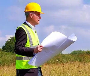
What Are Geophysical Surveyors?
Geophysical surveyors use geophysical surveys to explore the earth, the surface, and what lies beneath without the need for excavation. These surveys help us understand physical properties, water depth, rock layers, buried objects, and other subsurface features.
Geophysics supports archaeology, construction, energy, land checks, and environmental research. By using proven geophysical methods, we provide useful knowledge about each site, helping clients make safe choices before work begins.
Key Services Offered by Geophysical Surveyors
We provide a wide range of geophysical survey services for different project needs. Our team delivers geophysical surveys, geophysical survey solutions, resistivity surveys, magnetic surveys, and mapping for commercial and residential work.
Our surveys collect accurate data to support planning, design, and construction. By studying ground conditions, we identify buried objects, buried features, potential hazards, unexploded ordnance, voids, and other features that may affect a site.
We use geophysical expertise to assess each location and provide clear analysis. Our services help clients understand risks, reduce delays, and move forward with confidence. Every project is handled with care, experience, and clear reporting.
Techniques and Equipment Used in Geophysical Surveys
We carry out reliable geophysical surveys using ground penetrating radar, ground penetrating radar GPR, resistivity, electromagnetic surveys, magnetometers, and other instruments. This equipment allows us to map features, measure depth, and investigate the ground beneath a site.
Ground penetrating radar GPR is commonly used to identify buried services, objects, voids, piles, and foundations. Ground penetrating radar also helps create high resolution images of subsurface features, giving our team useful information before excavation or construction begins.
Resistivity surveys help us analyse physical properties and tiny variations in the ground. These techniques show changes in earth materials, rocks, layers, water, and ground conditions. Magnetic fields and magnetometers can also detect disturbances caused by buried objects, unexploded ordnance, and other features.
Our geophysical surveys provide accurate results by combining data, mapping, analysis, and site context. This approach helps us deliver clear insights, ensure reliable results, and support each project from early study to final action.
Applications of Geophysical Surveys
Geophysical surveys have many applications across archaeology, construction, land development, seabed mapping, and environmental work. In archaeology, surveys help explore archaeological potential without damaging important remains.
On land, geophysical surveys are used to identify buried services, mine workings, voids, foundations, unexploded ordnance, and changes in ground conditions. This information helps developers, engineers, and planners understand each location before work starts.
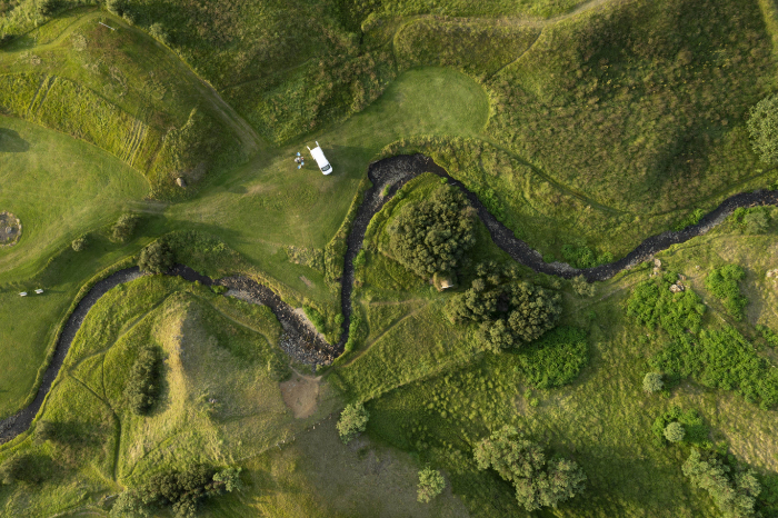
For water-based projects, hydrographic surveys help map the seabed, seafloor, ridges, water depth, and seabed features. These surveys can be carried out from a vessel and are useful for marine construction, piles, cables, and coastal work.
Our geophysical survey solutions support both small sites and large areas. By combining geophysics, mapping, data, and expert analysis, we provide information that allows us to inform design, reduce risk, and meet project requirements.
Summary of Applications
Solar Farms: Geophysical surveys help to map what lies beneath the ground before solar panels are installed. These surveys can locate buried services, old foundations, piles, and changes in soil, rocks, or ground strength. This helps reduce the risk of damage during excavation and trenching. It also helps designers place support structures where the ground is stable.
Linear Projects: Linear projects include roads, railways, and power cables that cross long areas of land. Geophysical surveys create a clear picture of ground conditions along the route. They can identify weak ground, buried objects, variations, and features that may affect construction. This support helps teams work quickly, safely, and with fewer unexpected issues.
Pipe Lines: For pipelines, geophysical surveys are used to check the ground along the planned route. They help identify existing pipes, cables, voids, buried objects, and ground conditions that could create risk. The results allow engineers to choose safer routes, protect assets, and design suitable support. This means fewer leaks, less damage, and better long-term performance.
Commercial and Residential Developments: On building sites, surveys are used before foundations are designed. They can detect old basements, mine workings, rubbish pits and variations in ground strength. This helps engineers choose the right type of foundation and avoid hidden hazards. It also supports planning applications by showing that ground risks have been properly assessed.
Scheduled Ancient Monuments: Around protected archaeology sites, geophysical surveys allow investigation without digging. They can reveal buried walls, ditches, roads, and other features while leaving the monument undisturbed. This helps archaeologists build understanding of the site and its context. It also guides nearby construction so that important remains are protected.
Benefits of Hiring Geophysical Surveyors
Choosing our geophysics team means you gain access to proven expertise, strong experience, and clear support. We provide geophysical surveys that uncover important information, including depth changes, voids, seabed conditions, land risks, and hidden features.
Our services are designed to help clients avoid damage, delays, and costly mistakes. For every project, we use trusted techniques to collect, analyse, and report data. This helps ensure results match your requirements, time frame, and project needs.
We can undertake surveys on land, across large areas, and in marine settings. Whether you are concerned about unexploded ordnance, seabed conditions, buried objects, or ground risks, our team can deliver accurate results and useful insights.
We also share clear reports, mapping, and analysis so you can understand the evidence and take action. Our knowledge of geophysics, surveys, and site conditions allows us to provide practical information for safe work.
Frequently Asked Questions
Geophysical Surveyors
Find out more about our geophysical surveyors and geophysical surveys from our frequently asked questions. For further information, please get in contact on 01522 704900.
A geophysical surveyor studies what lies beneath the surface using geophysical techniques. They measure physical properties, layers, magnetic fields, water depth, and ground conditions to understand subsurface features without excavation.
Geophysical surveys are needed before construction, archaeology work, infrastructure projects, and site checks. They help identify potential hazards, buried objects, unexploded ordnance, and other features that could affect your project.
Surveyors carry equipment across the site or use a vessel for hydrographic surveys. The equipment sends signals into the ground, seabed, or seafloor. These signals create data that is used for mapping, analysis, and reporting.
Yes. The techniques we use are safe, non-intrusive, and suitable for people, animals, and the environment. Geophysical surveys reduce the need for digging and help protect the site.
The time depends on the survey area, location, access, and conditions. A small site may take a few hours, while large geophysical surveys can take several days. Each survey is planned around the project needs.
Costs vary depending on the size, location, survey type, requirements, and conditions. Please contact us for a tailored quote based on your site and the services you need.
Yes. Surveys can identify buried objects such as pipes, cables, services, and other features. Ground penetrating radar gpr is often used for this type of work.
Geophysical surveys measure underground properties using remote techniques and equipment. Geological surveys study earth materials, such as rocks, samples, and visible ground conditions.
Light rain is often fine, but heavy rain, poor surface conditions, or strong winds may delay work. This helps protect equipment, ensure accurate results, and keep the team safe.
You receive a clear report with survey results, mapping, images, data, and analysis notes. These explain the findings, show the presence of key features, and provide support for your next steps.
Book a Geophysical Survey
Book a geophysical survey to gain clear, reliable insight into what lies beneath the ground, seabed, or seafloor before work begins. Professional geophysical surveys can help identify buried features, hidden structures, unexploded ordnance, changes in ground conditions, and possible risks that may affect your project.
Whether you are planning construction, archaeology work, land development, hydrographic surveys, seabed mapping, or site checks, geophysical surveys provide useful data without large-scale excavation. Get in touch today to discuss your location, requirements, conditions, and the best survey method for your needs.

Our Location
Pre-Construct Geophysics
47 Manor Rd, Saxilby
Lincoln, LN1 2HX
Contact Us
01522 704900 07734 958015 pcgeophysics@outlook.com