
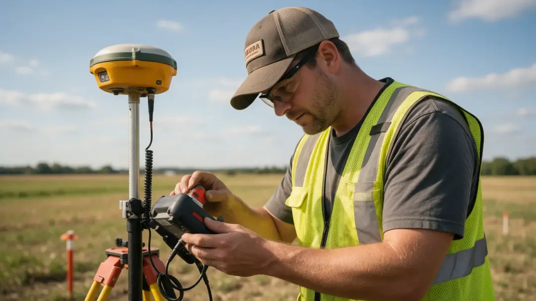
Common challenges faced by geophysical surveyors include weak target contrast, interference, difficult access and ambiguous interpretation. Good practice addresses these before and during fieldwork, then explains the remaining uncertainty in the report so a client can make an informed investigation decision.
The Target May Not Contrast with Its Surroundings
Geophysical methods detect differences in physical properties. A buried feature can remain undetected if its response closely matches the surrounding ground. A soil-filled cut may lack magnetic enhancement, while a foundation built from similar material to local rock may have little electrical contrast.
The surveyor therefore evaluates detectability before selecting equipment. Target size, depth, material and background conditions matter together. A successful survey of one neighbouring field does not guarantee identical performance across a different soil or geological unit. The brief should recognise where the selected method is unlikely to answer the question.
Modern Infrastructure Can Dominate the Signal
Metal fences, vehicles and reinforced structures can overwhelm weak magnetic responses. Power systems may introduce electrical interference, and traffic or machinery can complicate seismic measurements. Modern services and demolition deposits add patterns that resemble or obscure the target.
A reconnaissance visit can identify some of these problems. Survey timing, stand-off areas, an alternative method or agreed interruptions to site operations may help. Where interference remains, the report should map the affected zone instead of presenting it as confidently investigated. Removing noise in software does not necessarily recover a target whose signal was never distinguishable.
Access Restrictions Create Gaps in Coverage
Tall vegetation, steep slopes, crops, standing water and unsafe surfaces can interrupt systematic collection. Buildings and active compounds may prevent suitable survey lines. These gaps can affect interpretation because the missing area may contain the connection between two otherwise separate anomalies.
Agree access and ground preparation in advance, and record the actual boundary surveyed. A coverage map should show exclusions accurately. Estimates across an unsurveyed patch must not be presented as measurements. Where the missing ground is important to the decision, the team should plan a return visit or suitable alternative investigation.
Weather Changes Conditions Rather Than Just Comfort
Dry ground may make electrode contact difficult, while changing moisture alters electrical contrast. Wet surfaces can affect access and equipment deployment. Temperature changes may contribute to instrument drift or change the properties being measured.
Field logs should capture relevant conditions and repeated checks. If conditions vary sharply during a survey, compare control measurements and consider whether parts of the dataset remain comparable. Scheduling and pilot measurements can reduce wasted effort, but sometimes postponing collection is more defensible than producing a dataset that cannot support the required interpretation.
Read related articles:
The Role of Geophysical Surveyors in Construction
Geophysical Surveyors in Mineral Exploration
Sampling Can Miss the Pattern You Need
Spatial sampling must be dense enough to resolve the target. Collecting measurements faster while walking does not automatically compensate for widely spaced survey lines. Small anomalies can be missed, distorted or aliased when the sampling does not represent their variation.
A May 2026 research preprint compared a continuously sampled magnetometer at 90 Hz with stop-and-measure observations roughly 200 metres apart along a 20-kilometre Scottish transect. It demonstrated the importance of data density for that geological investigation. This experimental comparison is not a specification for routine archaeological surveys. Source: Scholes and colleagues, 2026 preprint.
Positioning Errors Can Become Interpretation Errors
A clear anomaly in the wrong position is difficult to investigate reliably. Satellite reception, incorrect coordinate transformations and offsets between a sensor and positioning antenna can all influence mapping. Problems are especially consequential when a small feature is being targeted for verification.

Use suitable control, record the coordinate reference system and check the dataset against known positions. Document how sensor offsets are handled. A report should state positioning limitations rather than implying survey precision from the number of decimal places displayed on a plan. The mapped accuracy must suit the decision the client intends to make.
More Than One Ground Model May Fit
An inversion produces an explanation consistent with data and constraints, but another model may also fit. A small shallow source and a larger deep source can sometimes generate similar observations. Smoothing and assumptions about two-dimensional ground can further influence a modelled boundary.
The EPA identifies existence, uniqueness and instability as central inverse-problem difficulties. Source: US EPA inversion guidance. Practical responses include testing alternative models, reviewing sensitivity and combining independent evidence. Reporting a plausible interpretation with confidence categories is more useful than hiding uncertainty behind a single definitive-looking image.
Control Measurements Help Catch Problems Early
A repeat station or control line can show whether measurements are drifting during the day. Calibration checks establish that equipment responds as expected, while comparison of adjacent traverses may expose offsets or positioning problems. Detecting an issue in the field gives the team a chance to investigate it while the equipment and site access are still available.
The quality-control plan should identify the checks suitable for the instrument, how often they will be made and what discrepancy triggers action. There is no universal acceptable percentage for every method and target. A weak archaeological response may demand different controls from regional geological mapping. Keep the original data, processing record and field notes so adjustments remain traceable. A convincing final image does not justify an undocumented correction; the report should retain enough information for another competent reader to understand why the dataset is considered fit for its stated purpose.
Communicating Limitations Is Part of the Work
Clients need to know what was measured, which targets were detectable and what a negative result means. The report should distinguish observed responses from interpreted causes and identify follow-up needed to resolve significant uncertainty. Technical terms should support that explanation rather than obscure it.
When discussing a site with Pre-Construct Geophysics, provide the intended decision, access constraints and known disturbance. Agree the deliverables and how uncertain areas will be handled. A well-scoped survey helps the project progress even when its answer is that additional evidence is required, rather than an unsupported assurance that nothing lies below ground.
Summary
Survey challenges arise from the ground, surrounding infrastructure, sampling and the interpretation process. Careful planning and quality checks reduce avoidable problems. Clear reporting of coverage, detectability and uncertainty ensures the remaining limitations inform the next investigation instead of being overlooked.
Share your site conditions and objectives with Pre-Construct Geophysics to discuss geophysical work that addresses the uncertainties important to your project.
Geophysical Surveys