
What Are Archaeological Geophysical Surveys?
Archaeological geophysical surveys are non-intrusive investigations used to identify possible buried remains without excavating the ground. Specialists collect measurements across a site using instruments that respond to changes in magnetic properties, electrical resistance or reflected radar signals. These measurements are processed into plans that may show ditches, pits, walls, roads, buildings, kilns and other features linked to past human activity.
The main methods are magnetometer survey, ground-penetrating radar and electrical resistance survey. Each method detects different physical contrasts, so the most suitable choice depends on the ground conditions and the type of archaeology expected.
A geophysical survey does not normally confirm the exact date, condition or importance of a feature. Instead, it helps archaeologists identify patterns and decide where further investigation may be useful. Within planning, survey results can help a planning authority understand archaeological potential before deciding how a proposed development should proceed.
Why Are Archaeological Surveys Needed for Planning Applications?
Archaeological surveys may be needed because development can damage or destroy buried evidence. Foundations, roads, drainage systems, service trenches, landscaping and ground reduction can all disturb remains that have survived below the surface. Once their position and surrounding context are lost, the information they contain cannot be recreated.
National planning policy expects applicants to describe the significance of heritage assets that may be affected by a proposal. Where land has archaeological interest or the potential to contain archaeological remains, the planning authority may request a desk-based assessment and, where necessary, field evaluation. A geophysical survey can form part of that evaluation.
The aim is not to prevent every development on archaeologically sensitive land. It is to provide enough information for a proportionate and informed planning decision. Results may show that no clear anomalies are present, identify areas that need trial trenching or reveal remains that should influence the site design.
Early survey work can also reduce uncertainty for the applicant. It allows possible archaeological costs, programme changes and design responses to be considered before construction begins. This can prevent important discoveries from causing greater disruption during groundwork.
When Is a Geophysical Survey Required?
A geophysical survey may be required when a proposed development site has known or suspected archaeological potential. This may become clear through a Historic Environment Record search, desk-based assessment, previous discoveries, historic maps, aerial images or the site’s location within an archaeologically sensitive landscape.
The local planning authority’s archaeological adviser normally decides whether this form of evaluation is appropriate. They may request it before an application is determined or through a planning condition after permission is granted. Requirements should be proportionate to the scale of development, likely ground disturbance and potential importance of the remains.
Geophysical survey is not suitable for every application or site. Small works with limited ground impact may need no field evaluation, while difficult ground conditions may require trial trenching or another method instead.
Applicants should seek advice early rather than commissioning a survey without an agreed scope. The archaeological adviser may issue a brief or require an approved written scheme of investigation setting out the survey area, method, reporting and archive requirements.
Which Developments May Need an Archaeological Survey?
Many forms of development can require archaeological investigation when they involve meaningful ground disturbance in an area of known or possible interest. Examples include housing schemes, commercial buildings, industrial sites, roads, utilities, energy projects, mineral extraction, schools, leisure developments and major landscaping works.
The size of the project is important, but it is not the only factor. A small development beside a scheduled monument, historic settlement or recorded burial site may create greater archaeological concern than a larger project in an area with little known potential. Extensions, agricultural buildings and drainage work can also require assessment where foundations or trenches may affect buried remains.
Planning authorities consider the proposed depth and location of groundworks. Piling, basements, access roads, attenuation ponds and service routes may disturb different parts of a site. A survey area may therefore extend beyond the building footprint.
Larger developments often need broader evaluation because they have a greater chance of affecting unknown archaeology. Sites near recorded remains, river valleys, historic routes or areas with limited previous investigation may also receive closer attention.
The requirement should always be based on archaeological risk and development impact rather than a fixed rule that applies to every project
How Planning Authorities Assess Archaeological Risk
Planning authorities assess archaeological risk by considering the available evidence and the likely effects of the proposed work. Their archaeological advisers may review the Historic Environment Record, designated heritage assets, historic maps, aerial photography, previous investigations, landscape features and information supplied in a heritage statement or desk-based assessment.
They also consider the size, depth and location of ground disturbance. A shallow surface treatment may present limited risk, while foundations, basements, roads and service trenches could remove archaeological deposits.
The authority may decide that existing information is enough, or it may ask for field evaluation. Geophysical survey can help identify possible buried features across a large area before more intrusive work is planned.
The final response should be proportionate. Some sites need no further investigation, while others may require survey, trenching, preservation or excavation. Early advice allows the scope to be agreed before the application progresses and reduces the chance that important information is missing when a decision is made.
The Role of Historic Environment Records
A Historic Environment Record is an information service containing evidence about the archaeology, historic buildings and landscapes of a defined area. It may include records of known monuments, previous excavations, find spots, historic maps, aerial evidence, archaeological reports and locally identified heritage assets. The information is updated as new investigations take place.
National planning policy states that the relevant record should be consulted when an applicant describes the significance of heritage assets affected by a proposal. It is normally an essential source for heritage statements and archaeological desk-based assessments.
The record can show whether a development lies near known remains or within a landscape where archaeology is likely. It may also reveal that surrounding land has produced evidence even when nothing has previously been recorded inside the application site.
An empty record does not prove that archaeology is absent. It may simply mean that the land has never been investigated. Archaeological advisers therefore combine record data with geology, topography, historic land use and the proposed development impact.
Professional contractors may obtain detailed information directly from the local record service. Public online sources can be helpful for early research, but they may not contain every current record or full supporting report.
Choosing the Right Geophysical Survey Method
The right survey method depends on the expected archaeology, geology, ground surface, burial depth and size of the site. Magnetometer survey is commonly used across open fields because it can cover large areas quickly. Ground-penetrating radar can provide depth information and may work over tarmac, concrete or floors. Electrical resistance is often useful where buried walls or foundations are expected.
No single method is suitable for every location. Magnetic disturbance from fences, buildings, services and modern debris can reduce the value of magnetometer data. Very dry, waterlogged or stony ground may affect resistance results, while certain soils can limit radar penetration.
The project objectives should guide the choice. A survey intended to locate broad settlement activity may use a different approach from one investigating detailed remains beneath a building. An experienced archaeological geophysicist should review the available evidence before recommending equipment, survey intervals and coverage. Sometimes two methods are combined because they detect different properties. The agreed method should be recorded in a written scheme of investigation and approved by the relevant archaeological adviser.
Magnetometer Surveys for Planning Applications
Magnetometer survey is the most widely used archaeological geophysical technique and is often the first choice for large, open development sites. The equipment measures very small changes in the local magnetic field as the operator walks or drives across the survey area in closely spaced lines. Buried ditches and pits may produce magnetic contrasts after becoming filled with topsoil and occupation material.
Burnt features such as hearths, furnaces and kilns can create particularly strong responses. Some walls and foundations may also be detected when their magnetic properties differ from the surrounding soil. The method can cover many hectares relatively quickly, making it useful for housing, infrastructure and energy developments. Results are normally shown as greyscale or coloured plots, with interpreted features marked on plans.

Magnetometer data can also contain responses from pipelines, fencing, vehicles, modern rubbish and geological changes. These may hide weaker archaeological anomalies or create patterns that resemble buried remains.
The survey works best when vegetation is short and the ground can be crossed safely. Metal objects should be removed where possible. Although useful for planning, magnetometry does not provide a complete record of every archaeological feature. Its results often guide targeted trenching or further investigation rather than replacing excavation entirely.
Ground-Penetrating Radar Surveys
Ground-penetrating radar sends pulses of radio energy into the ground and records reflections from buried materials and changes between layers. The time taken for a reflection to return can be used to estimate the depth of an anomaly. This method may detect walls, floors, voids, foundations, graves, services and other features with a strong physical contrast. It can be used across soil, tarmac, concrete and internal floors, making it helpful where magnetometer or resistance surveys are unsuitable.
Data is collected along close lines and can be processed into horizontal depth slices. These show how possible features change at different levels below the surface. Ground conditions strongly affect performance. Clay-rich or highly conductive soil can reduce penetration, while rough surfaces and dense vegetation may slow collection.
Radar data also takes longer to process and interpret than many magnetometer surveys. For planning applications, it may be chosen for urban sites, historic buildings, churchyards or areas where detailed depth information is important. The selected antenna and survey spacing must suit the expected target.
Electrical Resistance Surveys
Electrical resistance survey measures how easily a small electrical current passes through the ground. Archaeological features can affect soil moisture and therefore produce different resistance readings. Buried walls and foundations often retain less moisture than nearby soil, creating areas of higher resistance. Ditches and pits may hold wetter material and produce lower resistance.
Electrodes are inserted into the ground at regular positions while readings are collected across the site. The measurements are then processed into a plan that may show patterns linked to buried structures or cut features. Resistance survey can be particularly useful where masonry buildings, walls, roads or formal garden features are expected. However, it is generally slower than magnetometer survey and may be less suitable for very large development areas.
Results can change with soil moisture. Very dry summer conditions or heavily waterlogged winter ground may reduce useful contrast. Survey timing can therefore influence the quality of the information.
The surface must allow good contact between the electrodes and soil. Hardstanding, deep stone, dense scrub and some crops may prevent collection.
A resistance survey may be used alone or alongside magnetometry and radar. Combining methods can help compare anomalies and improve interpretation where the archaeological targets are complex.
Preparing the Site for a Geophysical Survey
Good site preparation helps the survey team collect safe and consistent data. Grass and other vegetation should normally be short enough for operators and equipment to move across the area without obstruction. Crops, dense scrub, brambles and tall weeds may need cutting or may require the survey to be rescheduled.
Livestock should be removed while fieldwork takes place. Vehicles, temporary fencing, stored materials and movable metal objects should also be cleared where possible, especially before magnetometer work.
The survey provider needs accurate site boundaries, access details and information about known services, hazards and landowner restrictions. The team should be told about wet ground, steep slopes, excavations, overhead cables and contaminated areas.
Recent ploughing can create an uneven surface, while standing crops may prevent the agreed coverage. A site visit or current photographs can help identify problems in advance. Permission must be in place before entry. Surveys of scheduled monuments may require additional consent. Preparation should avoid disturbing the archaeology itself. Deep clearance, stripping or ground levelling must not be carried out simply to make the survey easier unless this has been approved.
What Happens During the Survey?
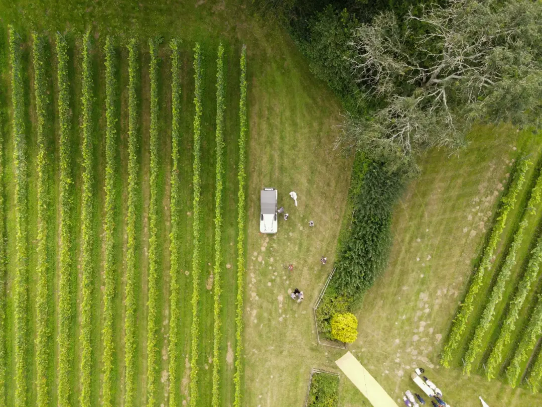
The survey team first confirms the site boundaries, access arrangements and health and safety controls. Reference points are established using accurate positioning equipment so the collected data can be linked to the development plan and mapped correctly. Operators then cross the agreed area along regular, closely spaced lines. A magnetometer may be carried using a frame or mounted on a cart or vehicle. Radar equipment is pushed or towed across the surface, while resistance instruments require electrodes to make repeated contact with the soil. Readings are stored digitally and checked during fieldwork. This allows the team to identify missing strips, equipment problems or areas affected by obstacles. Notes may be made about fences, services, buildings, ground conditions and visible features that could influence interpretation.
No excavation normally takes place. The work is intended to leave the archaeological deposits undisturbed.
After collection, the raw measurements are processed to correct minor errors and improve the visibility of meaningful patterns. The geophysicist then compares the results with maps, known features and site conditions before preparing an interpretation.
The project should follow the approved written scheme of investigation and any brief issued by the planning authority. Significant changes to the agreed method or coverage may need approval before the work continues.
How Long Does an Archaeological Geophysical Survey Take?
Survey time depends on the site area, chosen method, ground conditions, access and amount of modern disturbance. A small open field may be completed in a day, while a large housing or infrastructure site could require several days or weeks of fieldwork.
Magnetometer survey normally provides the fastest coverage. Ground-penetrating radar and electrical resistance often take longer because measurements are collected at closer intervals or require more detailed processing.
Tall vegetation, steep slopes, wet ground, livestock and obstacles can slow progress. Weather may also affect safe access and the performance of certain methods. Fieldwork is only one part of the programme. Data processing, interpretation, plan preparation, quality checks and report writing require additional time after the team leaves the site.
Applicants should ask the survey provider for a realistic programme that includes mobilisation, fieldwork, reporting and any review by the planning authority. Early booking is advisable during busy periods or when the survey must take place after crops are removed.
What Can a Geophysical Survey Detect?
A geophysical survey may detect buried ditches, pits, enclosures, roads, walls, buildings, kilns, hearths, furnaces, graves, field systems and areas of past industrial activity. It may also show modern services, drains, former field boundaries, geological changes and recent disturbance. What can be detected depends on whether the buried feature creates enough physical contrast with the surrounding ground.
A ditch filled with magnetic soil may appear clearly during magnetometry, while a stone wall may respond better to resistance or radar. Depth, size and preservation also matter. Large features near the surface are generally easier to identify than small or deeply buried remains. Some archaeological materials produce little measurable contrast and may not appear at all.
The results usually show anomalies rather than complete certainty. Their shape, strength and position are interpreted using professional judgement. Similar patterns can sometimes have natural, agricultural or modern causes.
A survey can therefore identify areas of archaeological potential, but it cannot guarantee that every feature has been located. It also cannot usually establish an exact date without supporting evidence.
Trial trenching may be used to test selected anomalies, confirm their origin and assess preservation. Negative survey results must also be considered carefully because unsuitable conditions can hide genuine remains.
Understanding the Survey Results
Survey results are normally presented as processed data plots and interpretative plans. The raw measurements may contain thousands or millions of readings, so processing is used to correct collection effects and make meaningful patterns clearer. The interpretation plan groups anomalies by their likely cause. Categories may include possible archaeology, former field boundaries, agricultural trends, geological responses, modern services, magnetic disturbance and uncertain features.
A clear circular or rectangular pattern may suggest an enclosure or building, but interpretation is not the same as proof. Similar responses can be created by geology, drainage, ploughing or modern activity. The report should explain the level of confidence and any limits affecting the results.
Applicants should avoid treating every anomaly as an archaeological structure or every blank area as free from archaeology. The importance of a result depends on its wider setting, likely date, survival and relationship to the development.
The planning authority’s archaeological adviser will review the findings with other available evidence. They may accept the survey as sufficient, request trial trenches or recommend design changes. A professional report should use plain mapping, accurate coordinates and clear explanations so planners, designers and other archaeologists can understand how the interpretation was reached.
What Is Included in an Archaeological Survey Report?
An archaeological geophysical survey report normally describes the development proposal, site location, archaeological background and reasons for the investigation. It should state who commissioned and completed the work and identify the agreed project objectives.
The methods section explains the equipment, survey intervals, positioning system, processing and interpretation approach. It should also record any areas that could not be surveyed and any conditions that may have affected results.
Plans normally show the site boundary, collected coverage, processed data and interpreted anomalies. Important features should be linked to clear reference numbers or categories.
The report discusses possible archaeological, modern, agricultural and natural responses. It should avoid claiming greater certainty than the data supports.
A conclusion summarises the archaeological potential and explains the limitations of the investigation. Supporting information may include photographs, technical details, archive arrangements and references.
Reports produced for planning should follow relevant professional standards and any local authority brief. The approved written scheme of investigation may set additional requirements for file formats, mapping, reporting, archiving and submission to the Historic Environment Record.
Submitting Survey Findings with a Planning Application
Survey findings may be submitted as part of a heritage statement, archaeological desk-based assessment or separate field evaluation report. The planning application should clearly identify the report and explain how its findings have influenced the proposal.
The document must normally include accurate plans that can be compared with foundations, roads, services, drainage and landscaping. This helps the archaeological adviser understand which anomalies may be affected. Applicants should check whether the local authority needs the report before validation, during determination or after permission through a condition.
Where pre-determination evaluation has been requested, submitting an incomplete application without the results may delay a decision. The authority may require the contractor to send a digital copy to the Historic Environment Record and complete relevant project records. Local reporting procedures should be confirmed before work begins.
Survey findings should not be presented without professional interpretation. The planning authority needs enough information to assess archaeological significance and development impact. Early discussion with the case officer and archaeological adviser can confirm whether the survey meets the agreed brief or whether additional work is required before the application can progress.
How Survey Results Can Affect a Development
Survey results can affect the layout, programme, cost and archaeological requirements of a development. Where few or no clear anomalies are found, the planning authority may decide that no further work is needed or that limited monitoring is sufficient.
Possible archaeological features may lead to targeted trial trenching. The trenches can test whether anomalies are archaeological, establish their date and condition, and help assess their importance. If significant remains are present, the development may be redesigned to avoid them. Building footprints, roads, drainage ponds or service routes could be moved, reduced or constructed using methods that limit disturbance. Preservation beneath open space may also be considered.
Where avoidance is not practical and the effects are justified, excavation and recording may be required before construction. Conditions can be attached to planning permission to secure this work.
Exceptional discoveries of very high importance may create major design constraints or affect whether the proposal is acceptable.
Finding archaeology does not automatically mean that development must stop. The response should consider significance, impact and public benefit. Early results allow the design team to explore options while changes are still practical and before construction contracts are fixed.
When Further Archaeological Work May Be Required
Further work may be required when a geophysical survey identifies possible remains, produces uncertain results or cannot provide enough information for a planning decision. The archaeological adviser may request trial trenching to test selected anomalies and apparently blank areas.
Fieldwalking, test pits, metal detecting or earthwork survey may be suitable in certain settings. The choice depends on the site, research questions and limitations of the first investigation.
Where significant remains are confirmed, later work may include excavation, detailed recording or a watching brief during construction. Preservation within the development design may be preferred for important deposits.
Additional work may also be needed when survey coverage is incomplete because of vegetation, buildings, waterlogging or modern disturbance. A different geophysical method may provide better information.
Each stage should have an agreed written scheme setting out objectives, methods, reporting and archive arrangements. Applicants should not assume that completing geophysics will remove every archaeological requirement. A staged approach allows investigation to remain proportionate. Broad survey identifies patterns, trenching tests them and mitigation focuses on the areas that will be affected by development.
Geophysical Surveys and Trial Trenching
Geophysical survey and trial trenching are often used together because they provide different kinds of evidence. Geophysics can examine a large area without excavation and identify patterns that may represent buried features. Trial trenches expose selected parts of the ground so archaeologists can confirm what those anomalies mean.
Trenches may target strong survey responses, possible structures and areas that appear blank. Testing blank areas is important because some archaeological features do not produce a clear geophysical response.
Excavation can provide physical evidence about depth, condition, date and significance. Finds, soil layers and environmental material may be recovered and studied. Geophysics alone usually cannot provide this level of certainty.
The survey can make trenching more focused and efficient, but the trench layout should not only follow the strongest anomalies. It must also sample the development area in a balanced way.
The planning authority’s archaeological adviser normally approves the trenching strategy through a brief or written scheme. Results from both stages are reviewed together.
This combined approach can show whether remains should be avoided, preserved, excavated or monitored. It reduces uncertainty while limiting unnecessary excavation across the whole site. Ground truthing of survey anomalies through targeted trenching is normal practice in many planning evaluations.
Reducing Delays During the Planning Process
Planning delays can be reduced by identifying archaeological requirements before submitting the application. Applicants should review local policy, consult the Historic Environment Record and seek pre-application advice where the site may have archaeological potential. A professional archaeological contractor can then prepare a suitable scope and written scheme. This should be agreed with the planning authority’s archaeological adviser before fieldwork begins.
Site access, crop schedules, landowner permission and vegetation clearance need early attention. Waiting until the final weeks before submission may create problems if the field cannot be surveyed or the contractor is unavailable. Allow enough time for fieldwork, data processing, reporting and authority review.
Further trenching may be requested after the results are considered, so the programme should include this possibility. Development plans should be supplied in an accurate digital format. Clear information helps the survey team map findings against proposed ground disturbance. Prompt responses to questions and complete report submissions can prevent repeated reviews. Early archaeological work may appear to add time at the start, but it can reduce uncertainty and prevent more disruptive discoveries once construction has begun.
If you need an archaeological geophysical survey, get in touch with us today! Pre-Construct Geophysics can help you see what's hidden beneath your site before any digging starts. We provide a range of detailed surveys to help identify archaeological features, buried objects, and any changes in the soil or ground surface, without disturbing the site. Our surveys are great for improving your design choices and reducing the risk of delays.